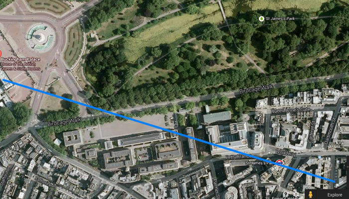
London transect: Constructing a transect to show land use change in a local area
A transect is a line or cross-section that shows the relationship between different features of the physical and built environments. In physical geography (for example in our Ecosystems at Risk topic) it might show a variety of different habitats, and can be used to study symbiotic relationships between different features. In cultural geography (for example in our Urban Places topic) it might show how certain urban functions are clustered together. Transects can also be used to examine the relationships between physical and cultural features (for example in our People and Economic Activity topic).
Examine the satellite images. Each image has a transect line across it. Draw a transect diagram showing the land use change that occurs across each transect. Write a paragraph describing the land use change. You may need to find the location on Google Maps and zoom in to find extra information.
Images created from Google Maps.
Transect 1
Transect 2
Transect 3


